


The compass is crucial in structural geology for measuring the orientation of geological structures such as bedding planes, joints, and metamorphic foliations.
It helps geologists determine the strike and dip of these structures, which is essential for understanding the geometry and pattern of relative movement within the Earth’s crust.
The compass is particularly important for structural geologists, who use it to measure foliation and lineation in metamorphic rocks or faults and joints in mining areas.
There are several types of compasses used in geological fieldwork, each with its own unique features and applications:
Geological compass-clinometer: this type of compass is used to measure direction components (azimuth, strike, and dip) and is available in two forms:
- Compass Azimuth: Divided into 360°, with the 0° and 360° points coinciding at the North.
- Compass Quadrant: Divided into four parts, with the highest number (90°) at the East and West, and 0° at the North and South.
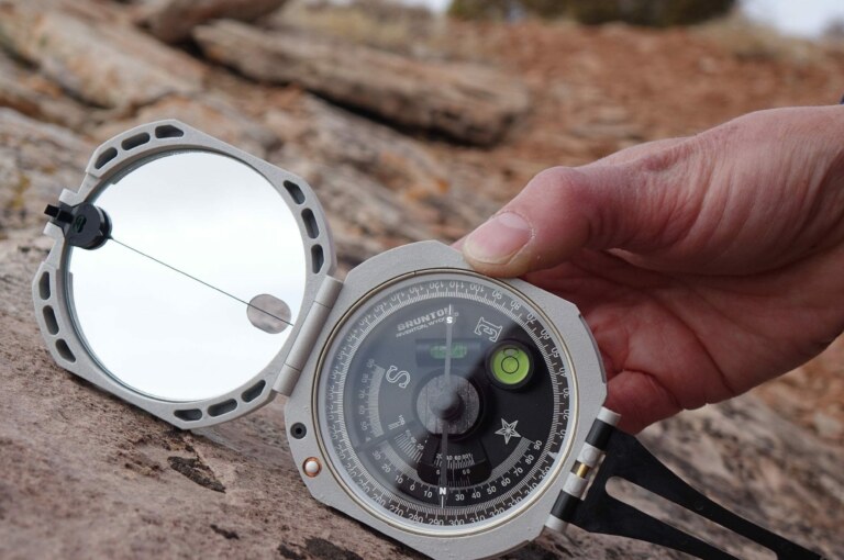
Brunton Geological transit compass: Known for its accuracy and durability, it features a level bubble, adjustable and locking dip needle, and a vertical circle for measuring azimuth and dip. It is available in both Quadrant (0-90°) and Azimuth (0-360°) bearings.
Freiberg geological compass: This compass allows for strike and dip measurements in one step, using the vertical circle for dip angle and the compass for strike direction. It has a declination adjustment and bubble levels for leveling.
Stratum compass: This type of compass is used for structural surveys and features a level bubble, adjustable and locking dip needle, and a vertical circle for measuring azimuth and dip.
These compasses are used to measure various geological parameters such as direction, strike, and dip, which are essential for understanding geological structures and processes.

